What's New in IC 2025

We are dedicated to continuously building the best geological subsurface analysis tool on the market.
For the latest version of Interactive Correlations (IC) 2025, we have focused on performance improvements to everyday tasks making IC even more reliable, dynamic and insightful than ever before.
Have even greater confidence in your interpretations by downloading IC 2025 today.
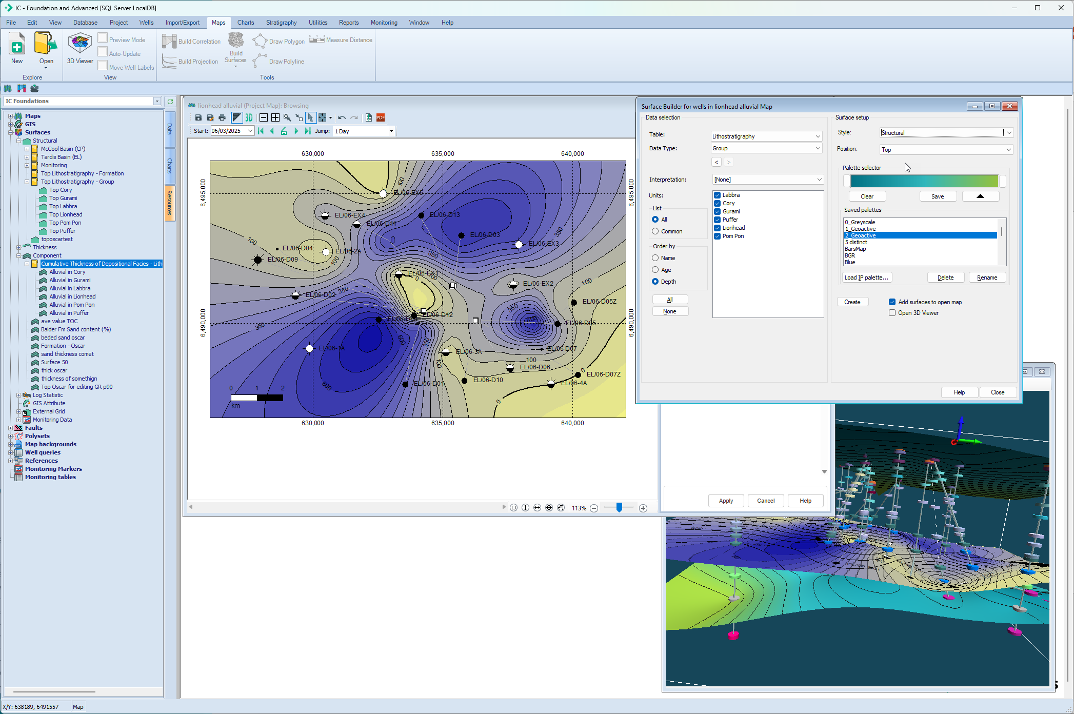
Updated Mapping Capability
- NEW: Time-saving Multi Surface Builder improvements.
- Improved Map Resources management, including duplicate surface names.
- Unlimited Map Toolbox well list to match project requirements.
- Improved subcrop and supracrop bubble precision.
- Enhanced Map Toolbox interactivity for Layers and Queries.
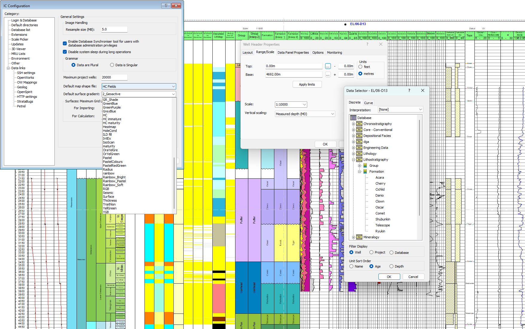
Enhanced Usability
- Display generation time now 8% faster.
- Added sorting option during data selection to help find units more quickly.
- Greater user control in IC configuration offers more options for customizing your visualizations.
- Broadened gradient colour palettes.
- Increased display scales for enhanced visualization.
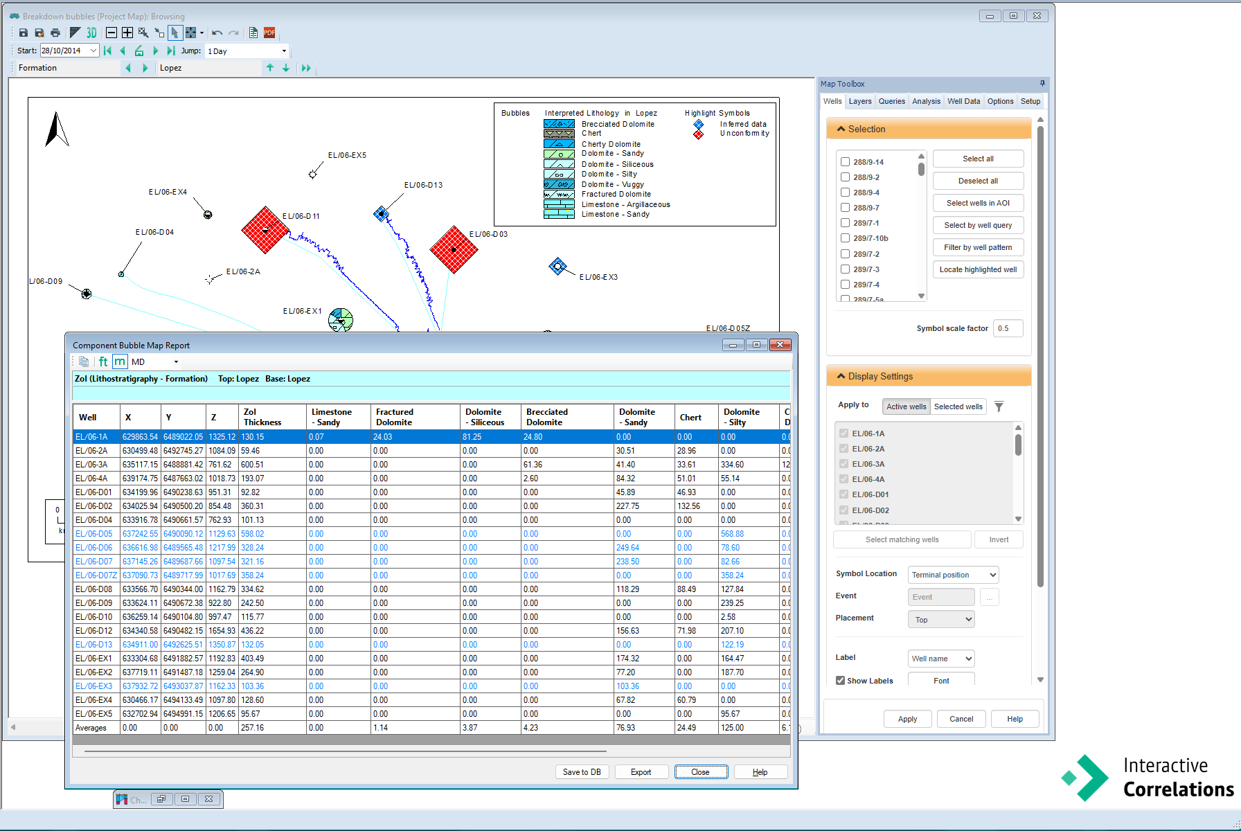
Upgraded Reporting & Data Management
- NEW: Bubble reports can now be saved directly to the database. Additionally, inferred stratigraphic zones are highlighted, and results can be displayed in MD or TVDSS, offering more flexibility in result displays.
- Refined discrete data management options.
- Enhanced reporting during data conversions.
- Faster and more robust reporting and exporting of reports.
- Increased limits for larger database summaries to match your project size, with table loading now 10x faster.
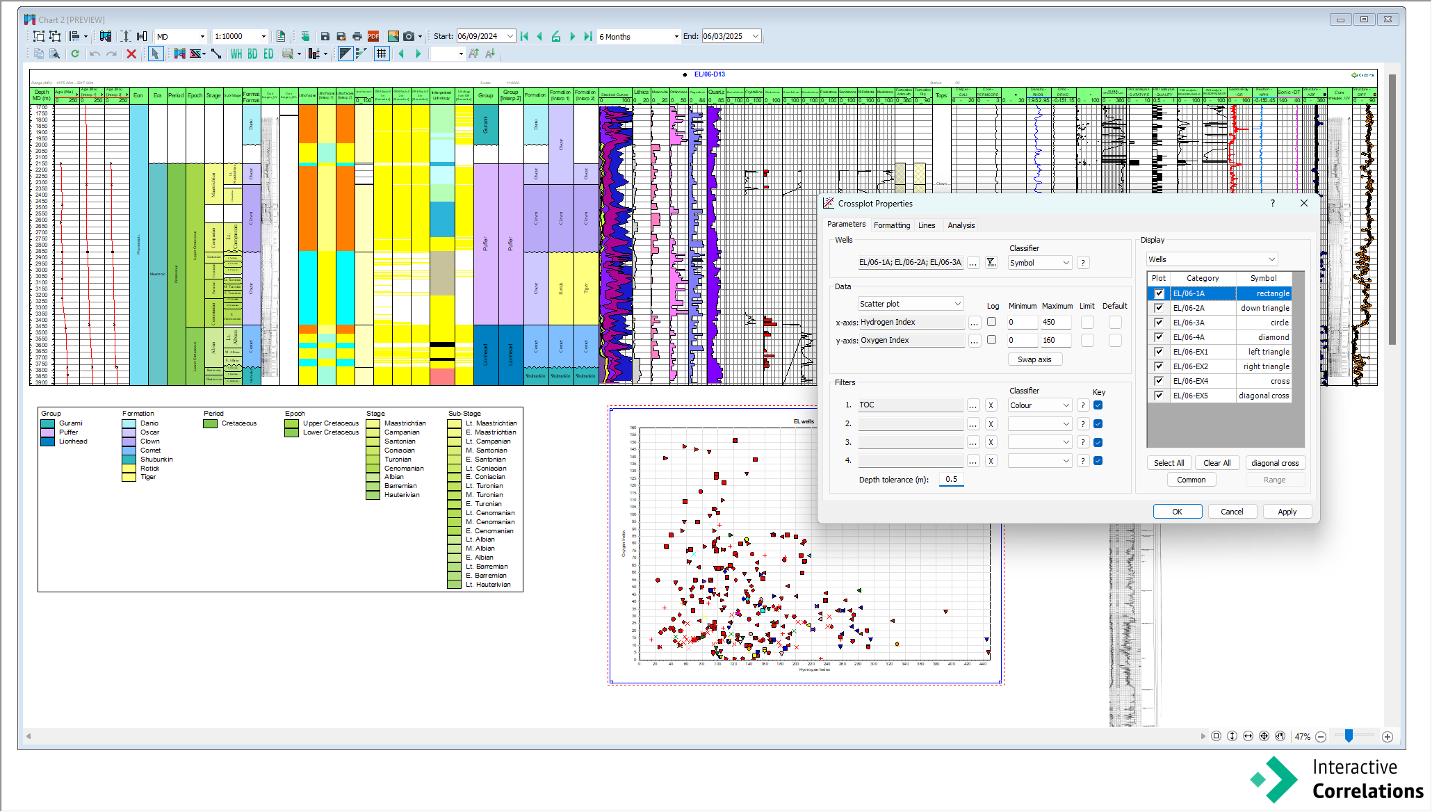
Refined Charts
- Crossplots: Added depth tolerance to numerical filters for enhanced understanding.
- Dynamic Template: Default setting now shows all interpretations.
- Ties Manager: Maintained zonal coloring options and pen style choices.
- Chart Key Panels: Enhanced to sort stratigraphically, including ranged units.
- Large Image Files: Improved display quality.
- Text Wrapping: Enhanced for better handling of extensive comment data.
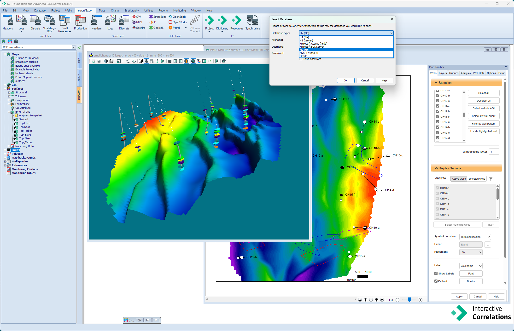
Updated Data Links
- NEW StrataBug 3.0 version link, including the new MV database, and removed StrataBug 1 versions.
- Updated link to Petrel 2024, with improved automated selection of non-standard CRS during import.
- Simplified import of undefined CRS position data.
- Enhanced ease of use for data import and improved ability to include special characters in data when exporting.
Toolkits